The foundation for a new beginning
When the opencast mine Inden I was opened in 1958 and, following the suspension (= temporary closure) of 1969, only resumed operations in 1981, the people of Inden knew that resettlement was now imminent. Some residents – for whatever reasons – were unable to wait for the resettlement of Inden, Altdorf and Pier, which was planned for 1989. Furthermore, based on its previous experience, the opencast mine operator assumed that 20–30 per cent of the population would not remain in their home area. It was necessary to address these out-migration trends to maintain a viable community in the long term. An active settlement policy was swiftly implemented:
- An commercial estate on Goltsteinstraße was designated, where a car dealership, the first supermarket (Diro-Markt) and a roofer from the old town of Inden set up business.
- Furthermore, as early as 1981, Development Plan No. 18 ‘Berger Benden’ a large residential area comprising 300 building plots between Wehebach and the old spoil tip was drawn up. The mining operator acquired the land and sold the building plots to residents from Inden and Altdorf, even though they were not yet ‘de facto’ resettlers. It was to become part of ‘Neu-Inden’.
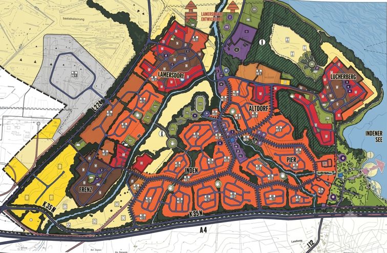
The 1981 master plan envisaged settling 8,000 residents there. In keeping with the spirit of the times, it was designed as ‘Rundlinge’ by the urban planning office of Prof. Zimmermann in Cologne. The current resettlement site was also originally intended to be developed in this form.
This strategic policy settlement pursued by the local authority proved successful. In 1986, the area was developed and the first homeowner from Inden moved there. The highly densely built-up residential area – with few green spaces – was well received. Only detached houses were built. In the 1990s, a few blocks of flats were also constructed in the Eisenbahnstraße area.
In 1990, the mining operator discovered that an active fault zone ran through the new development area. This was a geological fault which, due to the extraction of groundwater from the opencast mine (so called dewatering measures), could become active close to the surface. It could lead to mining-related damage to the existing buildings. The development plans were amended. The current green corridors (for example, the park by the town hall) were created along the fault zone; they must not be built on.
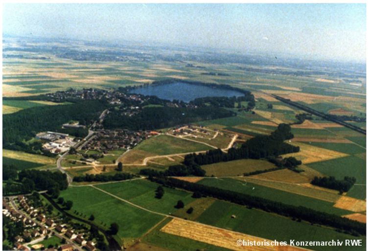
The residential area, which was separated from the future resettlement site by the Wehebach stream, was linked in 1992 by a bridge near the Lützelers estate. The communal fairground, the Driesch, was established here. Adjacent to this, the community centre was built by the local council. The community centre serves as a replacement for the many pubs in the old villages that were not rebuilt. Carnival meetings, exhibitions and club evenings are held here. There is a connecting path to the hotel-restaurant, enabling the owner to provide catering services to the community centre.
To the south of Development Plan No. 18, the Pier resettlement site was to be established. During the phased resettlement to Inden and Altdorf, most Pier’s residents opted for a resettlement site in Langerwehe-Jüngersdorf. The municipality of Inden offered building plots to residents of Pier who wished to remain in the municipality, not only in Schophoven-Rurerde but also between Development Plan No. 18 and Waagmühle. Approximately 20 per cent of Pier’s residents have settled in the municipality of Inden.