Mine railway – Assembly point – Coal bunker
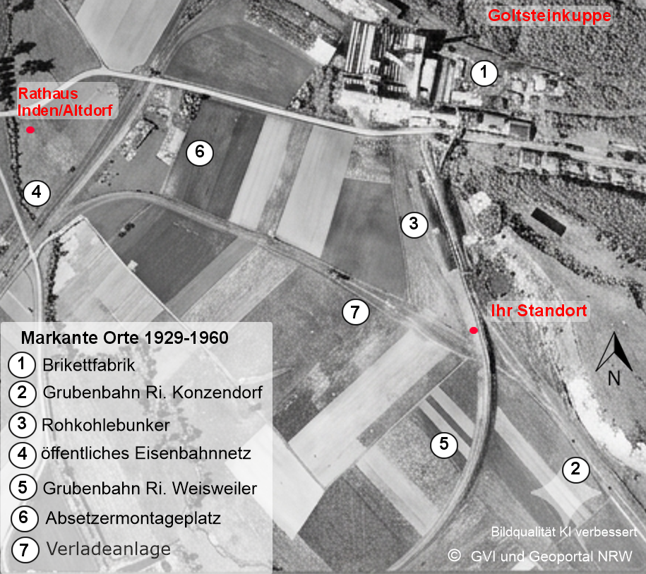
Once the opencast mines around Lucherberg had been exhausted, the Lucherberg briquette factory (Aerial image 1) and its power station began receiving raw coal from the ‘Alfred opencast mine’ near Konzendorf from 1929 onwards. The mine railway, which had been built as early as 1921, was used for this purpose (Aerial image 2).
A few hundred metres before the terminus at Lucherberg, the 7.4 km-long line forked: the northern branch led to the raw coal bunker (Aerial image 3) south of the briquette factory; today, this is the street ‘An der Kippe’, house numbers 1–23.
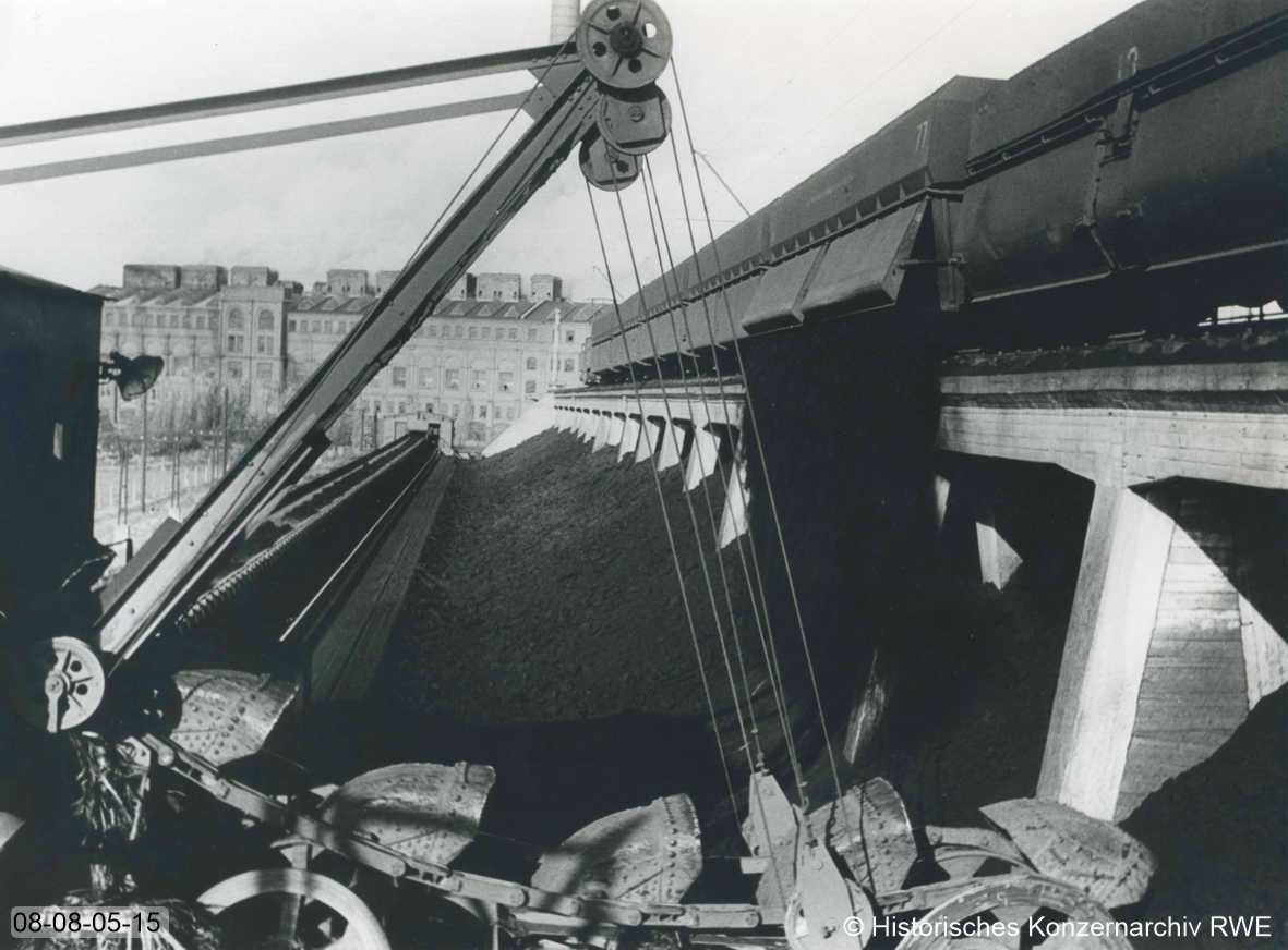
In 1954, looking north from this spot, you would have had this view of the raw coal bunker and the briquette factory.
The southern branch of the line ran along what is now ‘Eisenbahnstraße’ and joined the transfer station, which was connected to the public railway network (Aerial image 4). From there, briquettes and raw coal were transported onwards to destinations including the region’s paper and sugar factories.
Until the closure of the ‘Alfred’ opencast mine in early 1942, the raw coal came exclusively from Konzendorf. Thereafter, it was transported along the same route from the ‘Düren’ opencast mine, which had been opened in 1938; and, following the depletion of that mine from 1956 onwards, from the ‘Zukunft-West’ opencast mine near Weisweiler. To this end, a new, 5.2 km-long mine railway was put into operation as early as 1951 (Aerial image 5). In 1960, the Lucherberg briquette factory was closed. The transfer station had thus lost its function and was dismantled in the following years. The coal railway to Weisweiler was also dismantled, whilst the mine railway via Konzendorf to the ‘Düren’ opencast mine remained in operation.
South of Goltsteinstraße, to the left of the first house behind the former level crossing towards Lucherberg (now Goltsteinstraße 67, next to the town hall car park), the 746 unloader was installed in 1957 (Aerial image 6).
From May 1959 to July 1962, overburden from the ‘Inden 1’ opencast mine – which had been opened in 1958 – was transported via conveyor belts to the old Lucherberg ‘Opencast Mine 1’, known as the ‘Schlammsee’. This gave rise to the Goltstein hilltop.
From 1962 onwards, the same conveyor belt system was used to transport overburden from the ‘Inden 1’ opencast mine to backfill the ‘Düren’ opencast mine. The mine railway had been extended to include a second track for this purpose. In 1969, the backfilling of the ‘Düren’ opencast mine was completed; the remaining lake is now known as the ‘Dürener Badesee’. The railway line was dismantled.
The area south of what is now Goltsteinstraße, extending as far as the Wehebach stream to the west of the former railway line, was developed in 1978 as the first area for resettlement and built on from 1979 onwards. This was the site on which the loading facility (Aerial image 7) from the conveyor belt system to the overburden railway had been built. Today, this is the location of the streets ‘Berger Weg’, ‘Mühlenkamp’ and ‘An der Kippe 1–23’.
On the Lucherberg Cultural History Trail, you can explore the briquette factory and the early opencast mines in detail.